Tekirdag Suleymanpasa Barbaros Mahallesi
From Ancient Sources, 6th century BC. In the twentieth century, on the northern shores of the Sea of Propontis (Marmara), the existence of a city called Byzantium, founded by the colonists of Samos, was known. Again, according to Homer, Herodotus and Xenophon, indigenous peoples lived in the region before the establishment of colonial cities.
Although the location of the ancient city of Byzantinewas previously localized to Tekirdağ, the reading of the inscriptions found in Barbaros by Prof. Dr. M. Hamdi SAYAR in recent years and the results of the researches made in the region revealed the fact that the ancient Byzantine city was Barbaros.
Thrace entered the Persian domination after the Scythian expedition of the Persian King Dareios in 514-513 BC. This domination continued until the expulsion of the Persians from Thrace by the Attica-Delos naval unit established by Athens against the Persian danger in 478-477 BC.
King Kotys of Odrys (384-359 B.C.) established a powerful kingdom by gathering the Tracheans under one union. After his death, his son Kersepleptes (359-341 B.C.) was defeated by King Philip II of Macedon and the Thracian lands came under full Macedonian rule. After the death of Alexander, Lysımachos dominated Thrace.
The developments that started in A.D.19 when the Roman emperor Tiberius sent a governor to Thrace resulted in Emperor Cladius establishing the Roman province in Thrace in 46 A.D. and the Thracian Region remained under Roman rule for many years.
The name of Byzantine, which was a small coastal city in antiquity, was later changed to Panion and Panidos, today it is Barbaros. He minted coins in his own name. Although the ancient settlement area is mostly under the settlement of the new town today, traces of cultural assets are found on the coast of the town, in the Cemetery and Mines Areas.
Barbaros Madenler Mevkii is an area where the black-painted, polished characteristic ceramics of the 5th century BC are seen in abundance. In this region, which is a Grade III archaeological site, archaeological drilling excavations are carried out by the Tekirdağ Museum.
The walls running parallel to the sea in the cemetery area just west of Barbaros can be viewed in at least two phases. In the south of this area, which is still used as a cemetery in Barbaros, the site where Roman and Byzantine ceramics are seen intensively was given permission to carry out rescue excavations with the participation of the Department of Archaeology of Trakya University under the presidency of Tekirdağ Museum with the license of the Ministry of Culture and Tourism dated 07.06.2006 and numbered 91024, and as a result of the excavations, the existence of a church dated to the 13th century in this area was documented.
In the works carried out in 2006, the walls seen in the coastal part were also unearthed by finding a continuation towards the west. As a result of the examination of both small finds and architectural elements around the light, it was determined that this area was the spread area of the ancient Byzantine city in the Late Roman and Byzantine periods.
Barbaros, which remained within the borders of the Byzantine Empire in 395 AD, entered the Ottoman rule completely after the conquest of Istanbul in 1453, starting with the passage of the Turks to Thrace in 1353.
Geographical Structure
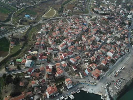
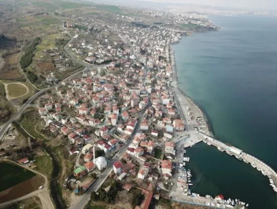
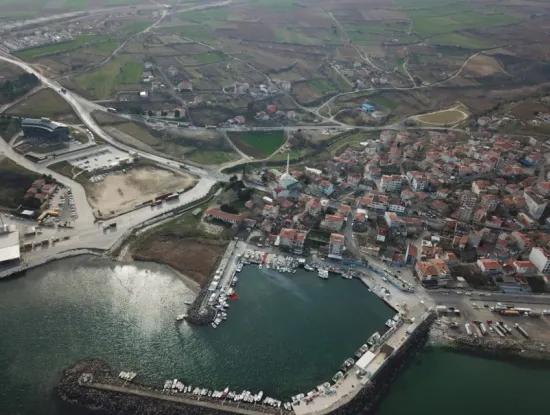
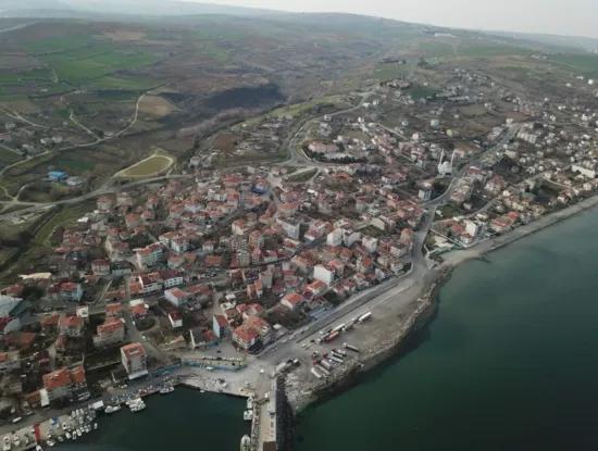
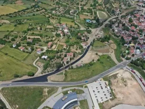
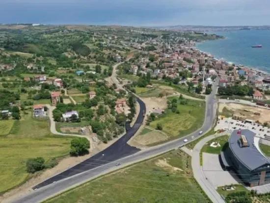
Barbaros Town as a geographical location; It is a coastal town with a front to the shores of the Sea of Marmara. It is located in the south of Tekirdağ province. Distance: 8 km to Süleymanpaşa, 130 km to Istanbul and 140 km to Edirne province. Away. Transportation to the town by road is provided in two ways. While coming from the direction of Süleymanpaşa; By turning left at the junction of the ring road, the town is reached by following the Barbaros - Kumbağ coastal road. The arrival from the direction of Keşan is as follows. Turn right at the ring road junction and follow the same road to reach the town. Çorlu or Istanbul Airports can be used for transportation by air.
Barbaros Town; It is surrounded by Süleymanpaşa, Kumbağ and Naip Village. Since June 7, 1987, it has been governed by the municipality, but with the new metropolitan law, the municipal organization has been abolished and turned into a neighborhood.
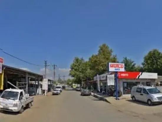
The town with a slightly undulating and sloping structure is suitable for settlement. The Süleymanpaşa-Barbaros main road has divided the settlement areas into two halves. The settlements have a collective textured appearance. Buildings such as mosques and schools are gathered around the square that forms the center of the town. The main source of income of the town is: agriculture, animal husbandry, tourism and trade. Fishing has an important place in the region.
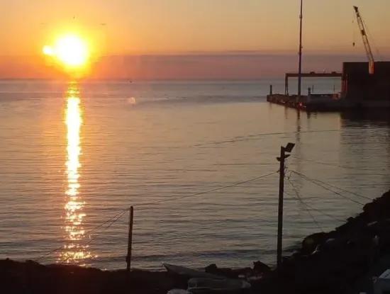
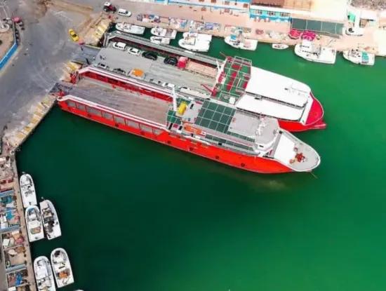
Barbaros, a coastal town, is also important in terms of tourism. The effect of the sea, the natural beauty of the town, its clean air and decent environment have a great impact on the touristic value of Barbaros. In the town, which attracts the attention of tourists with its clean beaches and beaches, the population reaches around 20,000 in the summer months. In the summer, the increasing demands are tried to be met with rental hostels and recreational facilities belonging to private institutions. From the town port; Ferry services are made to Marmara Island, Avşa Island, Erdek, Saraylar, Karabiga and Bandırma.
The main historical riches of the town, which is rich in natural beauties, are the ruins of the castle between the historical King's Road and the vineyards on the sea coast. There is a Health Clinic, a P.T.T. branch, an Agricultural Credit Cooperative, a Primary School and a Middle School in the town.
The population of 2019 is 5,028 people.
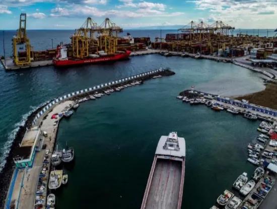
Asyaport Port
Asyaport was built exclusively as Turkey's largest container port on a sea fill area of 30 ha in Barbaros / Tekirdağ. In the port, the design of which was carried out with the seismicity of the Marmara Region in mind, the most advanced research and modeling techniques were used, including the design of the equipment to serve.
Asyaport projects; The studies of Istanbul Technical University, Boğaziçi University and Istanbul University in various fields of expertise were used. In addition, Belgium's Universities of Liege and Gennt have made various contributions. Built at depths of up to 20 meters, steel pipe piles with a diameter of 2.18 meters were driven in the docks. Maximum efforts are made to protect environmental, cultural and social values during the operation phase as well as during the plan, project and construction process.